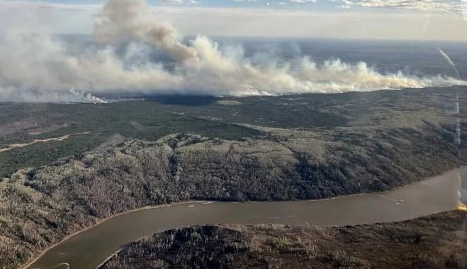
An evacuation order for Grande Prairie County has been partially downgraded to an alert late Saturday evening.
According to the Alberta Emergency Alert website, a wildfire four kilometres east of Teepee Creek, in the area of Range Road 31 and Township Road 740, is moving away from the community.
The alert is in effect from Kleskun Creek North to Township Road 742, as well as the Riverstone Golf Course.
An evacuation order is still in effect for everyone located from Township Road 750 to Township Road 730 and Range Road 31 and Smoky River.
The email you need for the day’s
top news stories from Canada and around the world.
However, residents in the above areas must prepare for a possible evacuation at any time.
An RCMP release on Sunday morning urged residents to follow evacuation orders and alerts and entry is not permitted while an evacuation order is in place.
Meanwhile, evacuation alerts are still in place for the Regional Municipality of Wood Buffalo (RMWB) after being expanded Saturday afternoon to include: Fort McMurray, Saprae Creek, Anzac, Fort McMurray First Nation #468, Gregoire Lake Estates and Rickards Landing Industrial Park.
According to the RMWB, the fire is around 12 kilometres west of Highway 63 and the highway is open as of 11 a.m.
The RMWB said Alberta Wildfire crews used night vision helicopters and dropped water on the southeastern edge of the fire overnight.
Six wildland firefighter crews as well as 13 helicopters and airtankers worked on the fire throughout Sunday, and heavy equipment worked to establish a fire guard on the northeast edge of the fire.
“Fire behaviour is subdued this morning but is expected to increase today as the temperature increases,” said an alert posted on the RMWB website.
“Winds from the southeast at 20 km/h are expected today and this should push the wildfire away from Highway 63 and towards the Athabasca River.”
© 2024 Global News, a division of Corus Entertainment Inc.


