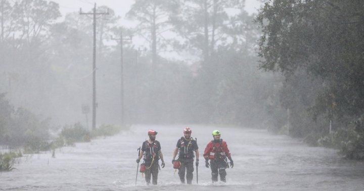
The Atlantic hurricane season of 2023 saw the fourth-most named storms since 1950, but an early forecast by researchers shows eastern North America could be in for an even stormier year.
Colorado State University (CSU) put out its yearly forecast on Thursday, its 41st since 1984, which has been widely watched since its inception.
According to projections, this year could see 23 named storms, with 11 becoming hurricanes and five considered “major,” which is when a storm sees winds of 178 km/h or 111 miles per hour.
“I’d say the thing that really stands out this year, which is a challenge forecasting as well, is the record-warm Atlantic sea surface temperatures that we’re seeing,” PhD candidate Alex DesRosiers told reporters Thursday.
“Hurricanes are powered by warm water, and that’s a lot of fuel out there for hurricanes that may form.”
DesRosiers said part of the concern comes from the dissipation of El Nino, which he notes last year created a more “hostile” atmosphere above the ocean for hurricanes.
As El Nino exits, it leaves behind a warmer ocean “ready to support hurricane activity.” Meanwhile, La Nina brings with it weaker winds high in the atmosphere, and the possibility of less wind shear to disrupt the storms.
If it comes to fruition, 2024 could become the year with the third-most named storms since 1950.

An average season — which runs from June 1 until Nov. 30 — produces 14 named storms, with seven leading to hurricanes and three turning “major.”
The email you need for the day’s
top news stories from Canada and around the world.
There is concern, DesRosiers added, about the northern Gulf Coast and Caribbean in part due to those regions often taking impact. But there’s more concern among CSU researchers about the amount of activity, as well as what DesRosiers says is more of a chance of something going “awry.”
While the CSU forecast appears to paint somewhat of a grim prospect for this year, Environment and Climate Change Canada climatologist David Phillips told Global News in an email that there is “too much uncertainty” for a forecast to come in April.
He pointed out that the National Oceanic and Atmospheric Association (NOAA) comes out with its own forecast, typically on June 1, with Canada typically joining U.S. forecasters in giving their outlook.
“April forecasts of the kind of a hurricane season really have no skill at all, I mean … it’s like flipping a coin,” Phillips told Global News in an interview.
Even if it’s a bit early, however, Phillips said the record warm temperatures and atmospheric conditions do give indication it’s likely there will be an active season, it’s just difficult to know how aggressive it will be.

He said what people can take from forecasts, whether “early” like CSU’s or ones put out by NOAA’s National Hurricane Center and the Canadian Hurricane Centre, is a chance to be prepared.
“It looks like it (the season) is going to be an active one, don’t be surprised, but it doesn’t necessarily mean it’s going to be for sure or that it will hit you,” Phillips said. “It’s getting the mindset from a winter kind of situation to a summer, tropical storm situation.”
Phillips noted this can mean cutting down tree limbs that could fall, knowing evacuation routes should that moment come, or having an emergency kit ready if you may be without power for several hours.
— with files from Reuters
© 2024 Global News, a division of Corus Entertainment Inc.


